
IHR WARENKORB IST AKTUELL LEER.
Haben Sie noch nichts passendes gefunden? Stöbern Sie durch unser komplettes Sortiment.
Oder melden Sie sich an bzw. registrieren Sie sich.
- Kostenlose Lieferung
- Kauf auf Rechnung
- Ex Libris Tiefpreis
- Filiallieferung und 650+ Abholorte
- Rabatt-Bons als Club-Mitglied
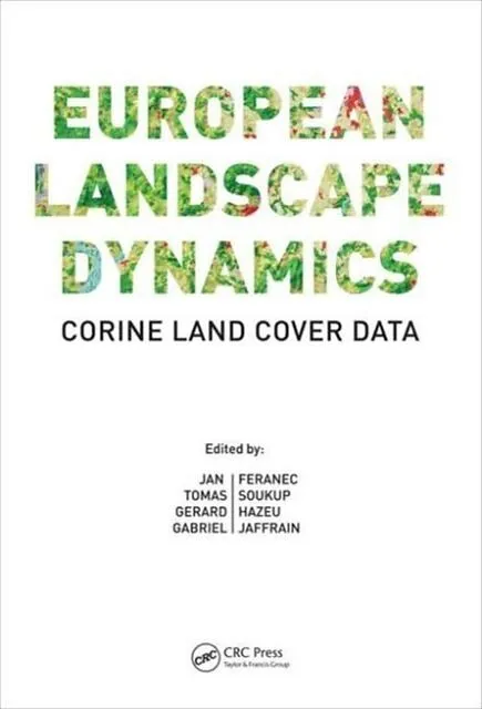
European Landscape Dynamics
Beschreibung
Zusatztext "A timely publication, this resource analyzes and presents patterns of land cover and land cover change across Europe, making the most of four steps in CORINE mapping since 1990. Providing comparable datasets, CORINE enables assessments of differenc...Format auswählen
- Fester EinbandCHF 284.00

Wird oft zusammen gekauft
Andere Kunden kauften auch
Beschreibung
Zusatztext "A timely publication, this resource analyzes and presents patterns of land cover and land cover change across Europe, making the most of four steps in CORINE mapping since 1990. Providing comparable datasets, CORINE enables assessments of differences in land cover change across the continent and in so doing informs policy development, as illustrated in some of the case studies provided. Future versions of this publication will be worth waiting for."Gearóid Ó Riain, Compass Informatics Ltd. London, UK"The innovative methods developed and used in this project not only helped improve our scientific understanding of land cover dynamics of Europe but also proved to be an excellent resource for land change scientists and practitioners all over the world."Chandra Giri, United States Geological Survey; Duke University; author of Remote Sensing of Land Use and Land Cover: Principles and Applications"Here, a reader can find in one publication the CLC methodical approaches, concepts of using satellite data, and related modern tools for data processing, including geoinformation systems. Thanks to this team of experienced authors and editors, this work provides a detailed comprehensive methodology of building databases as well as analyses and assessments of CLC outputs."Jan Kolar, Charles University, Prague, Czech Republic"it is not easy to grasp the state and change of land use/cover accurately, and the difficulty increases as one tries to study larger areas covering multiple countries or cultural regions, or to look at the change in a longer time range. It has been an exciting but difficult challenge to pursue in such complex region as Europe, but CORINE has done it beautifully with professional scrutiny. This book shows its achievement convincingly, with many informative original maps, diagrams and tables. It is hoped that this book is read widely, and gives clues to those who wish to develop similar land use/cover change data base in their countries or regions."Yukio Himiyama, Emeritus Professor, Hokkaido University of Education, Japan"Overall the book is a very thorough and a useful guidance manual, but also more than that, as it presents ways in which the CORINE datasets may be used to investigate some key contemporary environmental issues. It should be a useful reference volume and will help give budding and established researchers future project ideas. The production quality is very good, with colour figures throughout. The reliance on acronyms does make the eyeballs hurt on occasion, but otherwise it is quite readable given its technical nature." Progress in Physical Geography, December 2016"Overall, the authors have done an outstanding job of putting the most important information of the CORINE land data in one volume. If you use the CORINE data regularly, then you need this book at your fingertips."Photogrammetric Engineering & Remote Sensing, February 2017"The book provides a unique and valuable source of interesting insights into the history, methodology, and nomenclature as well as statistical analysis of the CORINE land cover and land use change products.[it] can be recommended as a valuable source of information for land use scientists, post-secondary students of geosciences, cartographers and practitioners, who need access to more in-depth information about CLC beyond available publications." International Journal of Applied Earth Observation and Geoinformation, July 2017 Informationen zum Autor Dr. Jan Feranec graduated in a physical and regional geography. He is a scientific worker at the Institute of Geography, Slovak Academy of Sciences, Bratislava, Slovak Republic, where he held the post of director from July 2002 to June 2006 and currently serves as the supervisor of PhD studies in physical geography, geoecology and geoinformatics. Dr. Feranec was appointed Associate Professor at the Comenius University in Bratislava in 1996. He is also the ...
Autorentext
Dr. Jan Feranec graduated in a physical and regional geography. He is a scientific worker at the Institute of Geography, Slovak Academy of Sciences, Bratislava, Slovak Republic, where he held the post of director from July 2002 to June 2006 and currently serves as the supervisor of PhD studies in physical geography, geoecology and geoinformatics. Dr. Feranec was appointed Associate Professor at the Comenius University in Bratislava in 1996. He is also the vice-chair of the current Commission on Sensor-Driven Mapping International Cartographic Association. His research interests include land cover/use and its change mapping by satellite images, urban areas analysis by VHR images and methodology of remote sensing data interpretation and landscape assessment as well as identification and analysis of abandonment of arable lands and grasslands. He has been involved in international projects such as the CzechoslovakiaCanada Cooperation in Remote Sensing, Ecotons of the Rivers Danube and Morava, MERA, Phare Topic Link on Land Cover, BIOPRESS, Urban Atlas (20092011 and 20132016). From 20012009 he was a member of the central CORINE Land Cover Projects (CLC1990 and CLC2000) Technical Team.
Tomas Soukup is project manager and a senior consultant in remote sensing, GIS and land monitoring for GISAT s.r.o. company, located in Prague, Czech Republic. Graduated in geodesy, cartography, GIS and remote sensing, he has worked extensively over the last 20 years on utilization of the Earth observation (EO) data for various practical applications in the land monitoring context including urban studies, regional planning, environmental assessment or emergency response and security support. Since the CORINE Land Cover 1990 mapping campaign in the Czech Republic and Slovakia, he collaborates with the European Environmental Agency (EEA) in the framework of European Topic Centers (PTL/LC, ETC/TE, ETC/LUSI, ETC/SIA. ETC/ULS) and also as member of the central CLC Technical Team. In the last decade, he has been active in numerous application projects for developing, testing and providing European GMES/Copernicus service capacities in land monitoring. He works with the National Reference Centre Land Cover in EIONET, a partnership network of the European Environment Agency, and he is also a member of the EEA EIONET Action Group on Land Monitoring in Europe supporting implementation of Copernicus services.
Drs. Gerard Hazeu is a physical geographer working at AlterraWageningen University and Research Centre, where he is a GIS & remote sensing researcher/project leader with specific interest in land cover/use change, agriculture and biodiversity issues. Since 2001, he has been involved in several European land monitoring projects. He is responsible for the CORINE Land Cover updates in the Netherlands (2000, 2006 and 2012). He has worked closely with the EEA in the European Topic Centres. He is also responsible for the Dutch national land cover database, which gives an actual representation of the national land cover every four years. He represents the Netherlands as the National Reference Centre Land Cover in EIONET. Currently, he is involved in several EIONET Action Group on Land Monitoring in Europe contracts (EAGLE), drafting the framework for future land cover monitoring in Europe. He also supports the implementation of the Copernicus land continental and local component by providing service specifications and ensuring continuity of the existing GIO land services.
Gabriel Jaffrain graduated in geography, environment, spatial planning by remote sensing and biology of organisms and ecology from the University of Rennes. He has been working as a project manager and a land cover/land use expert at IGN France International for more than 20 years and is now the referent for the environmental issues and land cover mapping topics. He is involved in numerous land occupation and environment projects in France and around the world. He has been involved with the CORINE Land Cover projects since 19…